Give us a call on 01903 861431 or send us an e-mail


Based just outside Brighton in Steyning, West Sussex, Archidata specialises in supplying topographical land surveys, measured building surveys, and BIM services for architects, construction professionals, self-builders and private individuals.
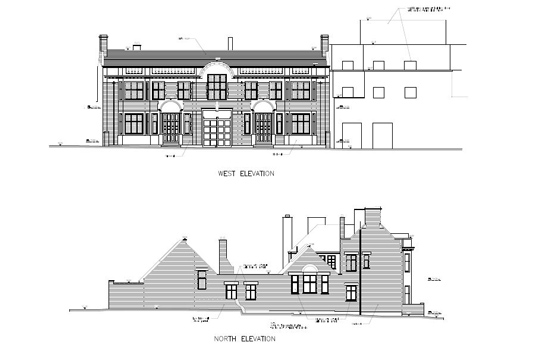
Architectural floor, roof, lease, area, legal and conveyance plans, elevations, cross sections, reflected ceiling plans, 3D wireframes, rendered CAD models, BIM models, verticality profiles and monitoring, fly throughs, precise floor slab surveys... all using the latest Bluetooth linked laser measuring equipment and software. Provided as 2D CAD drawings or 3D models in AutoCAD, Revit, BricsCAD, ArchiCAD or Sketchup.
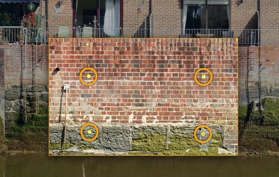
A monitoring survey can detect if or how far a building or structure has moved over time. The survey process involves monitoring specific markers at regular intervals, which can be daily, weekly, monthly, or even annually depending on the nature of the job.
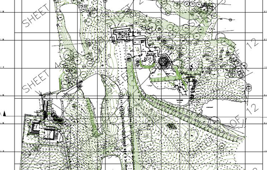
State-of-the-art robotic one-man Total Station theodolites and centimetre accurate Ordnance Survey linked GNSS/GPS equipment allow us to capture site data to provide accurate land surveys in a range of formats including DWG, DXF, PDF, XYZ, and RVT.
The level of detail can vary from a simple level survey with basic line work to a fully annotated plot of a complex urban scene.
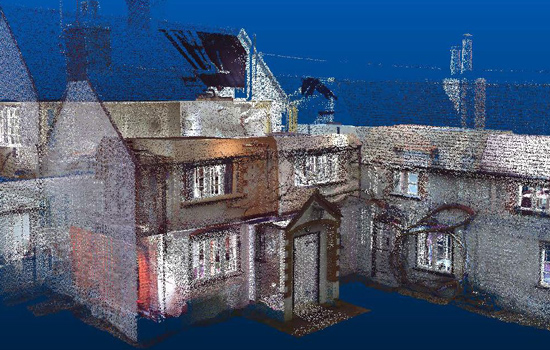
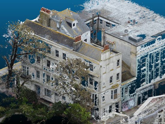
Fast and highly accurate colour or monochrome 3D data captured indoors and out, measuring your site in three dimensions to provide a comprehensive 3D Point Cloud of your land and property.
Our handheld mobile rapid LiDAR mapping system (GeoSLAM) allows for fast data capture, without complex set up or lengthy data processing. It's ideal for use indoors, underground and in environments where traditional GPS solutions don't function well, even dense woodlands!
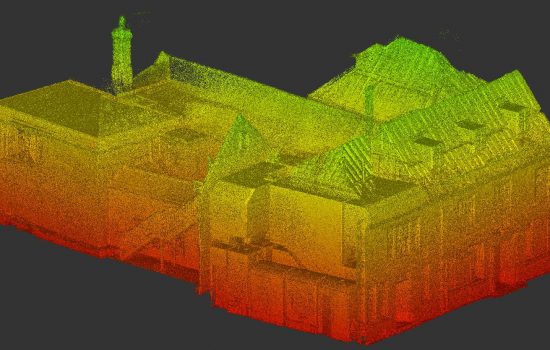
Our Point Cloud survey services leverage advanced 3D laser scanning technology to capture highly accurate spatial data of your site or property. Using state-of-the-art LiDAR scanners, we create detailed 3D models with millimeter-level precision, offering a faster and more cost-effective alternative to traditional surveying methods.
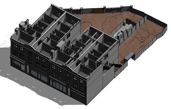
Full or partial 3D models from gathered survey data produced in a variety of formats to suit your needs for BIM, animations or simply for rendered visualisation purposes. Land surveys can provide digital terrain maps (DTM) with contours and almost instantaneous site sections. Data for sandboxing in Sketchup or topo surfaces in Revit, and XYZ/CSV files for import into CAD.
Archidata Limited
The Design Studio
94 High Street
Steyning
West Sussex
BN44 3RD
T: 01903 861431
Get in touch
Designed by Day 1
![]() © 2025 Archidata Limited. All rights reserved.
© 2025 Archidata Limited. All rights reserved.
Registered in England and Wales: Company No. 09970131.
Full Member No. 208 of The Survey Association
Participating member of The Survey Association's Continuing Company Development Scheme
