SPECIALIST LAND & BUILDING SURVEYORS
Receive A Free Quote From Us Today
BUILDING SURVEYOR, WEST SUSSEX
Specialist Land & Building Surveyors for Architects, Designers and Property Professionals
From precise one-surveyor robotic topographical surveys to high-definition 3D laser scanning for BIM and complex historic buildings, we deliver architect-ready survey data structured for immediate use.
By combining architectural insight with surveying expertise, we collaborate closely to provide exactly what each project requires, supporting confident design, planning and construction from day one.
We're Trusted, Nationwide.
ARCHITECTURAL SCANNING SPECIALIST
Why Choose Us?
By default, we combine our architectural training & surveying expertise to deliver drawings that are immediately usable by architects without the usual time-consuming rework. Archidata after all, means Data for Architects!
Unlike traditional surveyors, our plans are set up on drawing sheets exactly as an architect would expect, saving both time and cost. Where requested, we can tailor our surveys to sit directly on your title blocks, adopting your layering names, pen weights and styles so that our output slips seamlessly into your workflow.
A Statement From Our Director
“Trained in both architecture and surveying, I founded Archidata to raise the standards of survey mapping and information. We combine advanced laser scanning with architectural thinking to produce clear, reliable drawings and 3D models that integrate seamlessly into your workflow, reducing risk, saving time and supporting confident design decisions.”

Rob Mclean,
Director
A Statement From Our Director
”Trained in both architecture and surveying, I founded Archidata to raise the standards of survey mapping and information. We combine advanced laser scanning with architectural thinking to produce clear, reliable drawings and 3D models that integrate seamlessly into your workflow, reducing risk, saving time and supporting confident design decisions.
Rob McleanDirector
ARCHITECTURAL EXPERTISE
We Make It Easy For You
All our surveys are captured with the latest 3D laser scanning technology, ensuring absolute accuracy, speed on site, and the ability to provide additional information later without repeat visits. The scan acts as a complete “jelly mould” of the space.
We also take pride in the artistry of our CAD drawings: clear, elegant, and beautifully composed with considered pen weights and hatching that give depth and perspective without clutter.
While many surveyors deliver bare-bones drawings, often on a single layer, we go further with a logical “what you see is what you get” layering system that is simple, intuitive, and easy to navigate.
The result is a set of survey drawings that look great, read easily, and genuinely make your job faster, easier, and more cost-effective.
SPECIALIST ARCHITECTURAL SURVEYORS
View Our Latest Projects.
Dive into our case studies and explore the thinking, strategy, and craftsmanship behind our work. Each project showcases our commitment to quality and results.
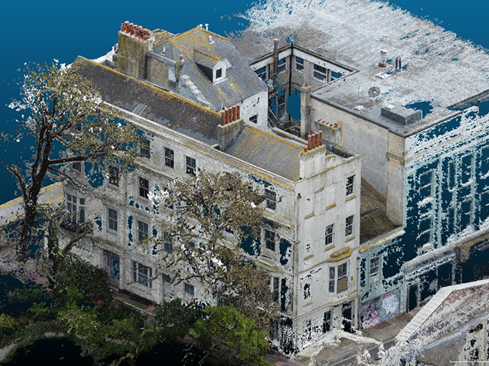
Palace Place, Brighton
Palace Place, Brighton
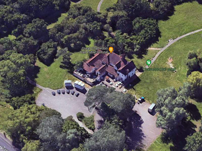
Great Chalvedon Hall, Basildon
Great Chalvedon Hall, Basildon
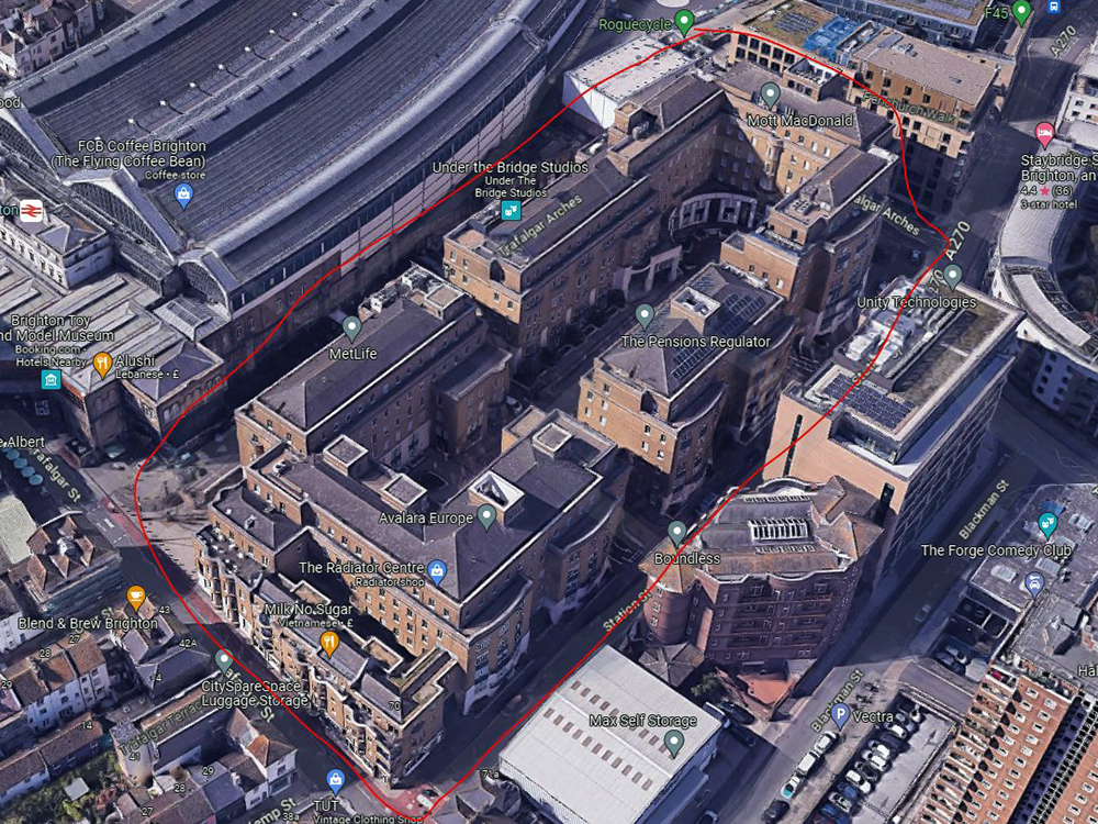
Trafalgar Place, Brighton
Trafalgar Place, Brighton
Want To Chat? Let’s Talk.
Whether you’re planning a new project or looking to improve what you already have, our team is here to help. Get in touch today and let’s explore the best way forward together.